pdf
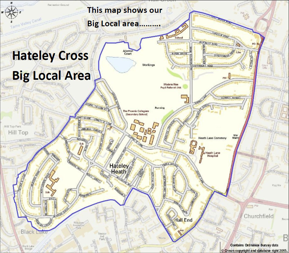
Download the map
(325 KB)
Street Listing
- Allerton Lane - B71 2HR/S
- Bank Street - B71 1HF
- Bedford Road – B71 2RS
- Berkshire Close – B71 2SJ
- Beverley Road – B71 2LP
- Caddick Crescent – B71 2DH
- Caldwell Street - B71 2DN
- Canterbury Close - B71 2LQ
- Canterbury Road – B71 2LA
- Cardigan Close – B71 1BD
- Clarkes Lane – B71 2BS
- Cumberland Road – B71 1HP
- Denbigh Crescent – B71 2RU
- Denbigh Drive – B71 2RJ
- Durham Drive – B71 1HS
- Ely Crescent- B71 2SD
- Essex Avenue – B71 1HU
- Glastonbury Road – B71 2LL
- Gordon Avenue – B71 2HT
- Heath Lane – B71 2BD
- Hereford Place - B71 2RR
- Huntingdon Road – B71 2RP
- Jowetts Lane – B71 2RB
- Jubilee Avenue – B71 2QT
- Jubilee street – B71 2DQ
- Kent Close – B71 2SL
- Kesteven Road – B71 1JH
- Leicester Place – B71 1LB
- Lellow Street – B71 2HP
- Lincoln Road – B71 2JE
- Lindsey Road – B71 1JY
- Lynton Avenue – B71 2QY
- Marsh Lane – B71 2DR
- Melrose Avenue – B71 2LW
- Monmouth Drive – B71 2SU
- Pembroke Way – B71 2SR
- Princess Grove – B71 2DS
- Radnor Green – B71 1JL
- Ripon Drive – B71 2JP
- Rutland Road – B71 1JP
- John Bosco Close - B71 2SG
- Salop Close – B71 2SB
- Shropshire Way – B71 1BJ
- Somerset Road – B71 1HN
- Stafford Drive – B71 2SA
- Stone Lea Close – B71 2LT
- Trotters Lane – B71 2QF
- Vicarage Road (Partly on one side inner part of the green line on map) – B71 1AW
- Vowles Road – B71 1AP
- Walsall Road (Partly on one side - inner part of the green line on map) – B71 3HE
- Westminster Road – B71 2JG
- Westmoreland Road – B71 1HL
- Wills Avenue – B71 2QS
- Wiltshire Way – B71 1JW
- Worcester Green – B71 1JD